Chichen Itza · Complete Guide
Chichen Itza: Ancient Maya City in Yucatan, Mexico
What the city was, who built it, what each monument shows, and what a visit involves in 2026.
Chichen Itza at a glance
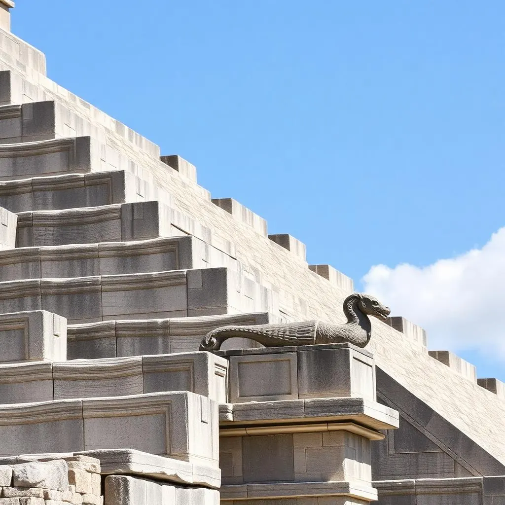
What Is Chichen Itza?
Chichen Itza is a ruined Maya city in the municipality of Tinum, Yucatan, Mexico, and one of the largest urban centres the Maya ever built. Its mapped zone spreads over several square kilometres of platforms, colonnades, causeways and cenotes, of which the fenced visitor circuit shows only the ceremonial core around El Castillo.
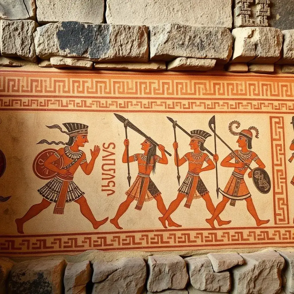
A city, not a monument
Plazas, ball courts, colonnaded halls, residential groups and water sources sit inside one planned settlement. The pyramid is one building in it.
Sacbeob, the white roads
Raised limestone causeways link the groups. Sacbe 1 runs about 300 m north from the Great Plaza to the Sacred Cenote and is roughly 6 m wide.
Most of it is still buried
Restoration cleared the plazas; beyond them the recorded buildings survive as vegetation-covered mounds that are closed to visitors.
Chichen Viejo reopened
INAH opened the southern Chichen Viejo group, including the House of the Moon and the Temple of the Initial Series, to guided visits in 2023.
Where Is Chichen Itza Located?
Chichen Itza stands at roughly 20.68 N, 88.57 W in the municipality of Tinum, Yucatan state, Mexico, in the middle of the northern Yucatan peninsula. Cancun lies about 200 km east by road, Merida about 120 km west, Tulum near 150 km southeast and Valladolid only 45 km away. Full drive breakdowns sit on the Cancun distance guide, the Merida route and the Tulum to Chichen Itza route.
Yucatan, not Quintana Roo
The site is in Yucatan state. Cancun, Playa del Carmen and Tulum are in Quintana Roo, which is why the ruins are a full day trip rather than a local excursion.
One hour behind the coast
Yucatan runs on Central Time and Quintana Roo on Eastern Time. An 8 AM opening in Yucatan is 9 AM on a Cancun or Tulum phone clock.
Toll road or free road
The 180D toll highway carries the distances above. The parallel free road passes through villages and adds close to an hour from Cancun.
| From | Road distance | Typical drive |
|---|---|---|
| Valladolid | ~45 km | 40 minutes |
| Merida | ~120 km | 1 hr 45 |
| Tulum | ~150 km | 2 hr 15 |
| Playa del Carmen | ~180 km | 2 hr 20 |
| Cancun | ~200 km | 2 hr 30 |
Chichen Itza in the Yucatan Peninsula: Map and Regional Setting
Chichen Itza sits in the northern interior of the Yucatan Peninsula, the limestone shelf that Mexico shares with Belize and Guatemala and that holds the Mexican states of Yucatan, Quintana Roo and Campeche. On a Yucatan Peninsula map the site falls almost midway along the Merida–Valladolid– Cancun corridor, about 40 km inside the Ring of Cenotes and roughly 120 km from the Gulf coast to the north. That inland position, not the Caribbean coast, is why every visit from Cancun, Playa del Carmen or Tulum crosses the peninsula rather than following it.
Where it falls on the peninsula
Northern-central Yucatan state, inland, on the flat karst plain — not on the peninsula's Caribbean or Gulf shoreline.
Peninsula, not just a state
The Yucatan Peninsula covers Yucatan, Quintana Roo and Campeche plus northern Belize and Guatemala's Peten. Chichen Itza lies in the Mexican Yucatan portion.
Ring of Cenotes
The site sits just inside the arc of sinkholes formed by the Chicxulub impact crater, which is why cenotes such as Ik Kil and the Sacred Cenote cluster nearby.
Other peninsula Maya sites
Uxmal, Ek Balam, Coba and Tulum share the same peninsula; the Chichen vs Coba vs Tulum comparison sets out which to pair in one trip.
| Reference point | Direction from the site | Approximate distance |
|---|---|---|
| Valladolid, Yucatan | East | 45 km |
| Merida, Yucatan state capital | West | 120 km |
| Gulf of Mexico coast (Progreso) | North | ~150 km |
| Caribbean coast (Cancun, Quintana Roo) | East-northeast | 200 km |
| Uxmal and the Puuc hills, Campeche border | Southwest | ~180 km |
How Do You Get to Chichen Itza?
Four ways reach Chichen Itza: self-drive on the 180D toll highway between Merida and Cancun, ADO intercity buses to the site or to Valladolid, colectivo vans from Valladolid, and organised day trips from the coast. Valladolid is the shortest approach at 45 km. Option-by-option detail sits in the guide to buses, car hire and day trips compared.
Driving
A car is the only way to be at the turnstile for the 8 AM opening. Parking sits at the main entrance and is charged separately from admission.
Tolls
The 180D charges at booths near Piste and Valladolid, payable in pesos cash. Rates are revised periodically, so confirm the current amount before you budget.
ADO bus
Scheduled coaches run from Merida, Valladolid and Cancun. The return timetable is the constraint, not the outbound leg.
What Does Chichen Itza Mean?
Chichen Itza translates from Yucatec Maya as “at the mouth of the well of the Itza”, from chi meaning mouth, chen meaning well, and Itza, the lineage that held the city. English speakers say chee-CHEN eet-SAH. The wells are the limestone cenotes that made permanent settlement possible on a peninsula with no rivers.
chi
Mouth, or the edge of an opening.
chen
Well: the natural cenotes that held fresh water in porous limestone.
Itza
The ruling lineage of the city. Colonial sources gloss the name as water sorcerers or water magicians.
The earlier name
The Books of Chilam Balam record the settlement as Uucil Abnal, sometimes written Uc Yabnal, before the Itza name attached to it.
When Was Chichen Itza Built?
Building at Chichen Itza began in the Late Classic period around 600 AD, and the city reached its height between roughly 800 and 1100 AD, across the Terminal Classic and Early Postclassic. Carved dates on its lintels cluster in the late 800s AD. Monumental construction stopped around 1200 AD, leaving the city standing but unfinished in places.
c. 600 AD
First monumental construction in the southern zone.
c. 750 to 900 AD
Puuc-style building at Las Monjas and the Iglesia.
Late 800s AD
The dated lintels: hieroglyphic inscriptions at Las Monjas and the Temple of the Initial Series carry the site's only firm calendar dates.
At its peak
Chichen Itza drew tribute, traders and pilgrims from across the peninsula. Population estimates run into the tens of thousands and vary widely between surveys. Dynastic dates, rediscovery and the 20 headline facts sit on the Chichen Itza history and facts guide.
Who Built Chichen Itza?
The Maya built Chichen Itza, specifically the Itza lineage that gave the city its name. Its inscriptions name lords rather than an anonymous dynasty, among them Kakupacal, recorded on lintels dated to the late 9th century. The unsettled question is the Toltec-style architecture of the northern group.
The Itza
Colonial Maya chronicles describe the Itza arriving in northern Yucatan and taking the settlement, then ruling from it.
A named lord
Kakupacal appears in hieroglyphic texts of the late 800s AD, one of the few rulers of the city known by name rather than inferred.
Who did the work
Limestone was quarried on site and faced by hand. Building at this scale needed organised seasonal labour drawn from the farming population, not a permanent workforce.
The architectural evidence
Serpent columns, warrior pillars, Chac Mool figures and the Temple of the Warriors layout resemble Temple B at Tula, Hidalgo, more than 1,000 km away.
El Castillo, the Temple of Kukulkan
El Castillo, the Temple of Kukulkan, rises about 30 metres including its summit temple and measures roughly 55 metres along each side of its square base. Four stairways of 91 steps plus the top platform total 365, matching the solar year. Nine terraces split by each stairway give 18 sections, the count of Maya calendar months.
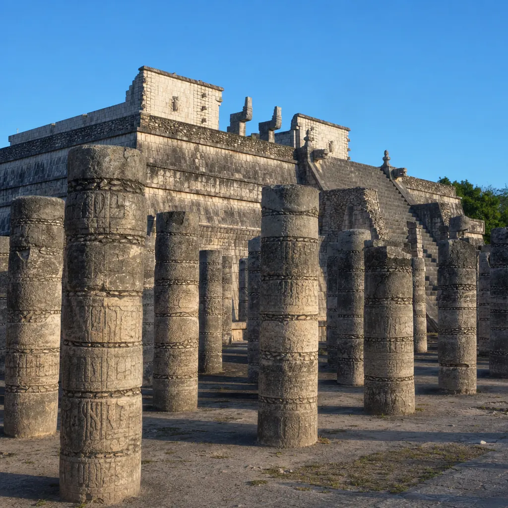
Two names
El Castillo is the Spanish name given after the conquest. Temple of Kukulkan is the name tied to the feathered serpent deity the building carries.
Half of it is restored
The 1920s and 1930s campaign rebuilt the northern and western faces. The south and east sides were left as found, which is why they look rougher and steeper.
Climbing is banned
Prohibited for over two decades, after a fatal fall and visible wear on the treads. The ban is enforced all day, as the El Castillo guide sets out.
Built without metal or wheels
Limestone blocks faced over a rubble and mortar core, raised with no metal tools, wheels or draft animals.
| Feature | Measure |
|---|---|
| Height with temple | ~30 m |
| Height to platform | ~24 m |
| Base, each side | ~55 m |
| Steps per stairway | 91 |
| Total steps with platform | 365 |
| Terraces | 9 |
| Terrace sections per face | 18 |
The Serpent Shadow and the Chirped Echo
Around the spring and autumn equinoxes, late afternoon sunlight strikes the northwest corner of El Castillo and the stepped terraces throw seven triangles of shadow down the western edge of the northern balustrade. The triangles meet the carved serpent head at the base, forming a body of light that appears to descend the pyramid.
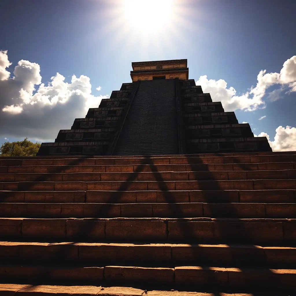
When to stand there
The effect peaks in the last two hours before the site closes, around 15:30 to 17:00, on the days near 20 March and 22 September. Exact dates sit on the equinox guide.
How the shadow forms
The sun drops toward the northwest, each of the nine terraces cuts one edge, and the overlap resolves into seven lit triangles running down to the stone serpent head.
How long it lasts
Visible for a window of roughly 45 minutes, and in weaker form for days either side. It is not a single-afternoon event.
Cloud cancels it
The triangles need direct low sun. An overcast afternoon removes the effect entirely, which is why some equinox visits show nothing.
The Great Ball Court
The Great Ball Court at Chichen Itza measures about 168 metres long by 70 metres wide, the largest known court in Mesoamerica, with a playing alley roughly 96 metres long between walls 8 metres high. Players moved a heavy rubber ball with hips, forearms and thighs at stone rings set high in each side wall, and carved panels along the base show a decapitation scene.
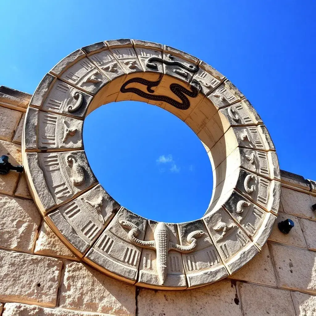
Thirteen courts, one giant
Chichen Itza has around a dozen smaller ball courts scattered through the site. The Great Ball Court is the one everybody photographs and the only one at this scale.
The rings
Set roughly 6 metres up the walls, with an opening around half a metre across. At that height and width, putting the ball through would have been rare.
The ball
Solid latex rubber, estimated at several kilos, heavy enough to bruise through padding. The Maya ballgame rules and scoring guide covers the equipment.
Sport or theatre
The scale has led some researchers to read the space as ceremonial theatre rather than routine competition.
Temple of the Warriors and the Thousand Columns
The Temple of the Warriors is a stepped pyramid fronted and flanked by rows of carved square and round columns known as the Group of a Thousand Columns. Warrior figures cover the pillars, a Chac Mool reclines at the temple entrance between serpent columns, and the layout closely resembles Temple B at Tula, Hidalgo.
An earlier temple inside
The pyramid encases the Temple of the Chac Mool, an older building with painted columns preserved by the later construction wrapped around it.
Excavated in the 1920s
Carnegie Institution archaeologists cleared and rebuilt the collapsed colonnade between 1925 and 1928. Detail sits on the Thousand Columns guide.
A roofed hall
The columns once carried a roof, almost certainly beams and mortar rather than vaulting, over a colonnaded hall used for assembly.
Not a thousand
Several hundred columns stand today, restored from collapse. The “thousand” is a modern label, not a count.
El Caracol, the Observatory
El Caracol is a round stone tower about 13 metres tall on a rectangular platform, named for the spiral staircase inside its core. Window slots in the upper chamber align with horizon points tied to the movements of Venus and to sunset at the equinoxes, which is why the building is read as an astronomical observatory.
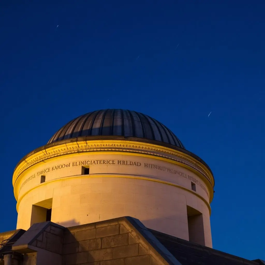
A rare round building
Maya architecture is overwhelmingly rectangular. Circular towers appear where the feathered serpent in his wind aspect is worshipped, which ties the form to Kukulkan.
Three windows left
Only a few of the original upper openings survive, so the alignments are reconstructed from what remains rather than from a complete set.
Venus sightlines
Northern and western sightlines through the surviving windows match Venus at its extreme northerly and southerly settings.
Equinox sunset
One diagonal sightline matches sunset at the equinoxes.
The Sacred Cenote
The Sacred Cenote is a natural sinkhole about 60 metres across, its green water sitting some 20 metres below sheer limestone walls. Dredging from 1904 onward recovered gold and jade offerings, copal incense, wooden objects, pottery and human remains, confirming it as a place of ritual deposit rather than a water source.
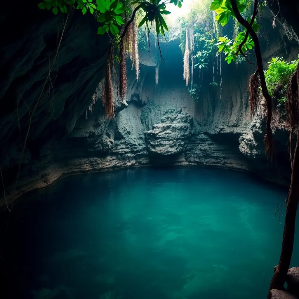
Two wells, two jobs
The city drew drinking water from other cenotes, Xtoloc among them. One well fed the city, the other received what the city gave up.
Who dredged it
Edward Thompson, the American consul who owned the hacienda, dredged the cenote from 1904, shipping finds to the Peabody Museum. The artefact record sits on the Sacred Cenote guide.
Diving followed dredging
Later expeditions in the 1960s used airlift equipment and divers, recovering material the bucket dredge had missed in the mud layer.
No swimming here
Swimming is prohibited at the Sacred Cenote. Ik Kil and the cenotes around Valladolid are the swimmable alternatives.
Secondary Monuments Most Visitors Walk Past
Beyond the main four, Chichen Itza holds the Tzompantli skull platform, the Platform of Venus, the Ossuary or High Priest's Grave, the Casa Colorada and Akab Dzib, and the Las Monjas group in the older southern zone. Together they show the site across two architectural eras, Puuc in the south, Toltec-influenced in the north.
Tzompantli
Faced on all sides with carved skulls impaled on stakes, alongside eagles tearing at hearts, jaguars and armed warriors. It stood in view of the Great Ball Court.
Platform of Venus
Carved with feathered serpents and the Maya star symbol, its panels pairing the Venus glyph with bar-and-dot numbers. A near-identical platform stands on the eastern plaza.
The Ossuary shaft
A vertical shaft runs from the temple floor down through the platform into a natural cave, where excavators found burials and offerings. It repeats El Castillo's plan at smaller scale.
Las Monjas
Misnamed “the Nunnery” by Spanish arrivals. Puuc architecture: long horizontal façades, stone mosaic panels, room ranges stacked in phases.
| Structure | What it is | Why it matters |
|---|---|---|
| Tzompantli | Low platform carved with rows of skulls | Held the rack that displayed sacrificial heads |
| Platform of Venus | Square stepped platform on the cenote causeway | Carries the Venus glyph and the 584-day count |
| Ossuary | Small pyramid over a burial shaft | Shaft descends into a natural cave beneath |
| Casa Colorada | Small Puuc building with red painted interior | Holds one of the site's dated hieroglyphic bands |
| Akab Dzib | Long low range with a carved inner lintel | Its name means dark writing, after that undeciphered text |
| Las Monjas | Range of stacked rooms, Puuc façades | The oldest substantial building group on site |
Maya Religion at Chichen Itza
Four deities dominate the carvings at Chichen Itza. Kukulkan, the feathered serpent, appears on El Castillo's balustrades and in the serpent columns. Chaac, the rain god, covers the Puuc façades in the south. Itzamna, the creator deity, and the maize god appear in reliefs tied to fertility and the agricultural year.
Kukulkan
Sovereignty and the calendar, carried by the equinox shadow and the serpent-head stairways.
Chaac
Rain, and by extension the cenotes and the maize crop that depended on both.
Itzamna
Creation, writing and priestly knowledge, associated with the specialists of El Caracol.
The maize god
The agricultural cycle, shown in cycles of death and regrowth.
The Maya Calendar Written Into the Site
Chichen Itza encodes calendar counts in stone. El Castillo's 365 steps match the Haab solar year, its 18 terrace sections match the Haab months, and recessed panels on the pyramid's faces are read as the 52-year Calendar Round formed by the 365-day Haab running against the 260-day Tzolkin.
Tzolkin
The 260-day ritual count, built from 13 numbers cycling against 20 day names, which set ceremonial dates.
Haab
The 365-day agricultural year of 18 months of 20 days plus a five-day remainder considered unlucky.
Calendar Round
The two counts paired. They return to the same combination after 18,980 days, or 52 years.
Long Count
Absolute dating appears in inscriptions rather than architecture, and Chichen Itza uses it more sparingly than southern cities.
| On the building | Calendar unit | Meaning |
|---|---|---|
| 365 steps | Haab | The solar year |
| 18 terrace sections | Haab months | 18 months of 20 days |
| 52 panels per face | Calendar Round | Haab and Tzolkin realigning |
| Venus glyphs on the platform | 584-day cycle | Venus synodic period |
Trade and Water
Chichen Itza grew powerful by controlling water and trade at once. Cenotes gave reliable water on a peninsula with almost no surface rivers, and the city held the routes linking the interior to the north coast salt beds and the port at Isla Cerritos, moving salt, obsidian, jade, cotton and cacao.
Salt was the volume trade
The Yucatan coast produced it in quantity and inland Mesoamerica needed it, giving whoever held the route a permanent income.
Long-distance goods
Obsidian from highland Guatemala and central Mexico, jade from the Motagua valley, gold from Central America, all of it turning up in the Sacred Cenote.
Isla Cerritos
An island port on the north coast, roughly 90 km from the city, where sea canoes met the overland routes inland.
Carried on backs
No wheeled transport and no pack animals existed here. Every cargo moved by canoe or on human porters along the sacbeob.
Why Did Chichen Itza Decline?
Chichen Itza lost its dominance around 1200 AD, when political power in northern Yucatan shifted to Mayapan. Monumental building stopped. The site was never fully emptied, and pilgrimage to the Sacred Cenote continued into the sixteenth century, when Spanish accounts record offerings still being made.
Drought
Sediment cores show dry intervals in this period, though the dating is not tight enough to pin a collapse to a specific decade.
Rival centres
Mayapan rose as the new capital and ruled northern Yucatan until its own collapse in the 1440s, leaving the region split among small provinces.
Not abandoned to the jungle
People were still walking to the cenote three centuries after the last temple went up.
The Spanish tried to settle it
Francisco de Montejo camped at Chichen Itza in the 1530s and attempted to found a Spanish town among the ruins. Maya resistance forced the abandonment of that attempt.
Rediscovery, Excavation and Restoration
John Lloyd Stephens and Frederick Catherwood published accounts and engravings of Chichen Itza in 1843, putting the site in front of a wide readership for the first time. Edward Thompson began dredging the Sacred Cenote in 1904. The Carnegie Institution ran major excavation and restoration from the 1920s alongside Mexican authorities.
1843
Stephens and Catherwood publish Incidents of Travel in Yucatan, with engravings drawn from camera lucida tracings made on site.
1904
Thompson's dredging of the Sacred Cenote begins and artefacts leave Mexico for the Peabody Museum at Harvard, some later returned.
1920s onward
Carnegie Institution excavation and reconstruction of the northern group, including the Temple of the Warriors and the Caracol.
1930s
Excavators tunnel into El Castillo and reach the earlier pyramid inside, with its red jaguar throne and chacmool still in place.
UNESCO and New7Wonders Status
UNESCO inscribed Chichen Itza on the World Heritage List in 1988 as a pre-Hispanic city of the Maya-Toltec period. In 2007 a worldwide public vote named it one of the New7Wonders of the World, a private campaign rather than a UNESCO programme.
1988, UNESCO
Inscribed under cultural criteria for its architecture and art, alongside Palenque and Teotihuacan among Mexico's earliest listings.
2007, New7Wonders
A global public vote run by a private foundation in Switzerland. UNESCO publicly distanced itself from the campaign at the time.
Why the difference matters
The 1988 listing carries conservation obligations and international monitoring. The 2007 title carries none, and both are accurate to claim.
Who owns the ground
The land under the monuments was privately held for decades and Yucatan state bought the core parcel in 2022, ending a long ownership dispute.
The Great Museum of Chichen Itza
The Gran Museo de Chichen Itza opened in 2024 beside the archaeological zone, built alongside the Maya Train works. It displays artefacts recovered from Chichen Itza and the surrounding region, including material that had been in storage rather than on show, and gives the site its first substantial permanent exhibition space.
Why it matters
The archaeological zone itself carries almost no interpretive signage, so the museum fills a real gap for anyone visiting without a guide.
What is inside
Sculpture, ceramics and carved stone from Chichen Itza and nearby sites, much of it excavated at Chichen Viejo and never publicly displayed before.
Where it sits
At the site's western access, the same side the Maya Train station serves, rather than the older eastern entrance.
How long to allow
An hour is enough for the current display, and it works best before walking the site rather than after.
Visiting Chichen Itza in 2026
Chichen Itza opens daily from 8:00 AM to 5:00 PM, with last entry at 4:00 PM. Entry costs 697 MXN for foreign visitors in 2026, charged as two parts, a federal INAH fee and a Yucatan state fee, paid at the gate. Mexican residents pay less. Deeper detail lives on the pages built for it: entrance fees and ticket types, 2026 opening hours and last entry, quietest months and weather by season, how to avoid the coach crowds, and what to wear and bring. If you would rather have the day handled, look at private tours with hotel pickup.
Arrive at opening
The 8 AM gate buys the coolest air and the emptiest plaza. Coaches from Cancun and the Riviera Maya land from mid-morning.
Best months
The dry season from November to April holds the most reliable weather. Equinox weeks in March and September are the busiest of the year.
How long you need
Two to three hours covers the core. Add an hour for the southern Puuc group and the museum.
Rules
Climbing every monument is prohibited and enforced. Drones need INAH permission.
See Chichen Itza with a local guide
Day trips from Cancun, Playa del Carmen, Tulum, Riviera Maya and Merida with hotel pickup, entrance handled and a certified guide who explains the site building by building.
Plan my visit on WhatsApp